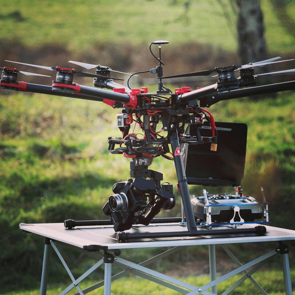
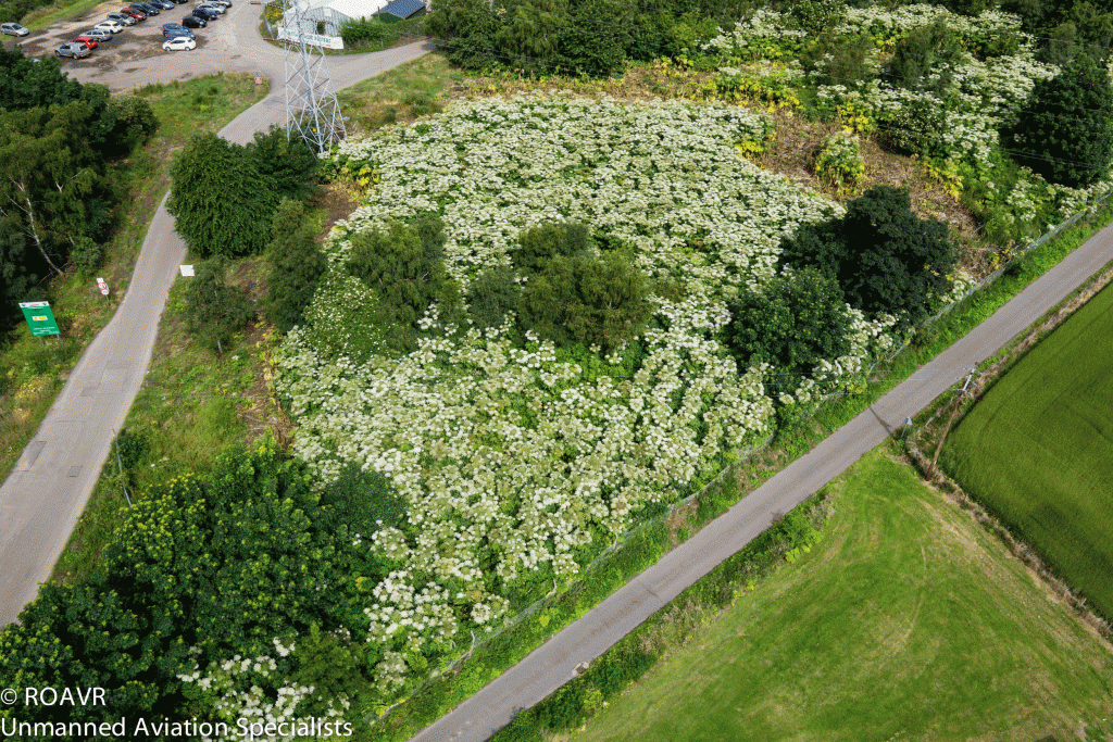
DRONES are being used in the fight against one of Scotland’s most dangerous plants.
A Scottish fisheries trust is using airborne technology to map out the Giant Hogweed that threatens their rivers.
The Findhorn, Nairn and Lossie Fisheries Trust (FNLFT) has been using unmanned aerial vehicles fitted with high-spec cameras to pinpoint the location of the invasive and toxic plant.
Giant Hogweed has stolen recent headlines, when a number of children and animals suffered severe burns after coming into contact with the weed.

But the species can also be a danger to ecosystems, “choking out” less aggressive plants and dominating the lifecycle.
Now the Trust, which protects rivers for anglers, fisheries and environmentalists, is using drones to safely measure the extent of the plant’s invasion as they move forward in their conservation efforts.
Inverness-based company Remote Operated Aerial Vehicles (ROAVR) provide the drones, which come equipped with a camera to allow video footage to be recorded.
The pilot scheme took place last week at the Lower River Findhorn in Forres, Morayshire, when a drone successfully covered 1.5 square kilometres in four hours.
The success means that the FNLFT no longer have to risk sending volunteer workers to survey infected areas.
Robert Laughton, Director of the Trust, explained that Giant Hogweed is a “big problem plant” and “a very dominant species which will choke out more native plants from the river.”
Speaking of their efforts to “bring it back under control”, he said it had thus far been “slow progress”, but they were expecting drones to radically improve efforts.
In the longer term they expect drone surveys to cover in one day the same area it could take ground surveyors up to two weeks, whilst eliminating the risk of burns.
Matt Harmsworth, Director and Pilot in Command of the project said ROAVR were approached as the Trust began “looking at ways of de-risking on the ground surveying and the best implementation of grant funding.”

He went on to explain the benefits: “Drone use covers great areas in a short space of time.
“Using fully autonomous flight plans we are able to re-visit the same site over and over again and produced geo-referenced maps.”
“We also have an in-house environmental consultancy so projects like this are a great use of our skill set.”
In addition to surveying for Giant Hogweed, drones are also being used elsewhere in the country to map invasive weeds including Himalayan Balsam and Japanese Knotweed.
Brought to the UK from central Asia in the 19th century, Giant Hogweed was initially used as an ornamental centrepiece for upscale gardens.
Growing up to 3.5m (11.5ft) tall, it can span up to 1m (3.5ft) across, with highly irritative sap which causes skin to become sensitive to light, leading to severe burns.
Extreme cases have seen children and animals suffering from third degree burns after coming into contact with the plant, which bears a resemblance to harmless cow parsley.
The highly-invasive and aggressive weed made its way out of gardens and into the wider ecosystem since being introduced in the UK, and is now a common sight on river banks, canal towpaths and woodland.

